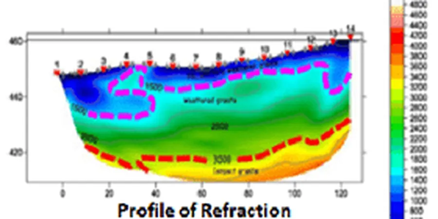
A recent warehouse expansion near the Mississippi River bluffs hit refusal at 12 feet. The driller called it bedrock. Seismic refraction lines showed it was a massive glacial erratic sitting on 20 more feet of compressible till. Minneapolis subsurface is a puzzle of glacial lobes, ancient river channels, and weathered Platteville limestone. Guessing gets expensive. We run 24- or 48-channel surveys with a sledgehammer or accelerated weight drop source. The output is a P-wave velocity model that maps competent rock, estimates rippability, and identifies buried valleys. For deeper targets, seismic reflection resolves stratigraphy beyond 100 feet using CDP stacking and geophone spreads tailored to the target depth. We correlate results with MnDOT boring logs and local geologic maps to ground-truth the interpretation.
A P-wave velocity model shows you where the real bedrock is, not where the auger stopped turning.